How to determine Heading and Groundspeed
Using the Wind down method
Get the appropriate upper wind information from the
Met Office website
Draw a line on your chart from your departure airfield to your destination or waypoint. use a protractor to determine the track. Measure the length of the track with the appropriate scale on your ruler.
The Navigation Computer solves Triangle of Velocity calculations for you.
Heading
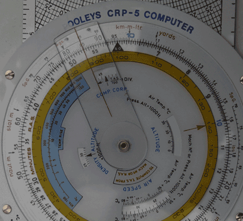
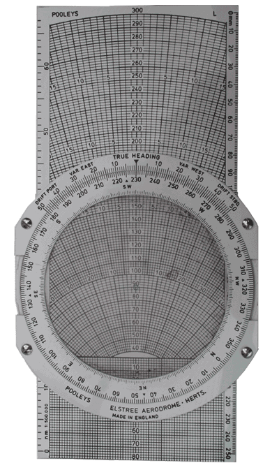 This is the Wind Face side of the CRP5 Navigation Computer, often called the Whizz Wheel.
There is a CRP1 Navigation Computer, which is smaller, but I prefer this one.
Using the Wind Face side
Move the wheel so that the wind direction is under the Index
Put the blue centre dot over a thick speed arc,
I use the 100 line
You will need to mark a dot for the wind velocity; I suggest a fine non permanent marker, these produce a more accurate dot and are easy to clean off.
So from the centre dot down mark the dot on the line representing wind velocity.
adjust the slide the till the TAS is under the centre dot
Now move the wheel so that the true track is under the Index.
The amount of drift is now shown. If it is to the right by 6° move the wheel 6° to the right, if it's to the left move it to the left.
Check the drift to see if it has moved. If it has, readjust. (See example below)
The amount of drift and the difference between the track and index mark should be the same.
Read the True Heading under the Index.
Read the Ground Speed (This is the wind line under your dot)
Apply the variation between Magnetic & True (marked on chart)
If it is west add it on and if it is east take it off
Groundspeed
Turn over the whizz wheel to work out how long it is going to take you to fly to your destination
Put the 60 index (little triangle with a 60 in it)on the inner circle under the gs
Look at the distance to fly on the outer circle
Put the cursor on the distance and read off how long it will take on the inner circle
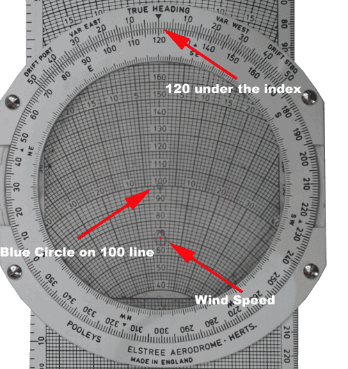
Example: Wind at 2000ft is 120/30. The Track to our destination is 230°T. The Distance to fly is 85nm
Put 120 under the index
Move the Slide so that a thick line is under the blue centre circle
Mark the wind speed down 30, on the 70 line. I've put a circle round it to make it easy to identify once you move it. (Thanks to Bob Bolster for that tip) |
|
|
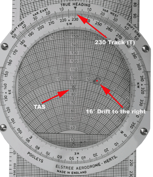
Put the TAS under the blue centre circle(I've used 90) Move the inner circle till your track(230) is under the index
Note the wind velocity is showing a 16° drift to the right.
|
|
|
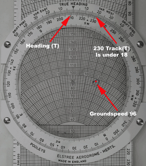
Move the inner circle 16° to the right (214)
Remember to add Magnetic variation and any compass deviation You will notice the track(230) on the inner circle is under the 18° drift line on the outer circle, so this is balanced with the drift showing on the wind face Read the groundspeed of 96 indicated under your velocity mark (dot) |
|
Turn over the whizz wheel to work out how long it is going to take you to fly the 85nm
Put the 60 index on the inner circle under the gs (96)
Look at the distance to fly on the outer circle(85)
Put the cursor on the 85 and read off how long it will take on the inner circle(53minutes)
Put the cursor over the picture for a closer look
|